Overview
In this lesson, students create a map of the Abenaki homeland, illustrating it with Abenaki place names.
Focusing Questions
Who first lived in the area we now call New Hampshire/Vermont? Can we find evidence of first peoples on today’s maps?
Topical Understandings
The Abenaki first lived in the area we now call new Hampshire/Vermont.
The Abenaki oriented their worldview toward the rising sun.
Native American place names are spread across the region.
These names reflect certain qualities: “wisdom sits in places.” – Apache Elder
Background Information
Who first lived in the area we now call New Hampshire and Vermont?
Materials
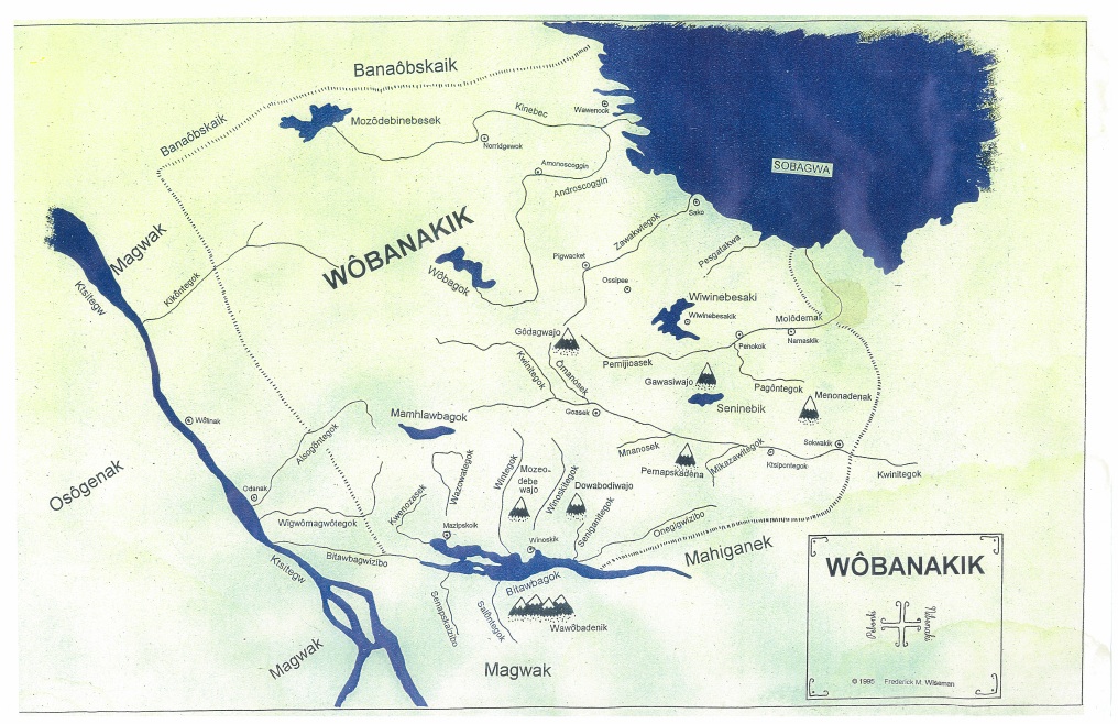
Abenaki Homeland Map (for teacher reference)
Blank Map Worksheet
Abenaki Place Names List
Colored Pencils
Procedures
- Introduction discussion
- Ask students to describe local Abenaki place names they know.
- Hand out the blank map of the Abenaki Homeland. This map should be oriented in “landscape” format with the coast ‘away’ from students, the title line ‘towards’ them, and the line cutting across the middle of the page, left to right. This is the Connecticut River. There are grids on this map to help with placing Abenaki locations (and later colonies and specific town)s.
- Have students take out a blue colored pencil or crayon and color in the water on the map—the Atlantic Ocean on top and to the right; and then the Connecticut River moving across the map.
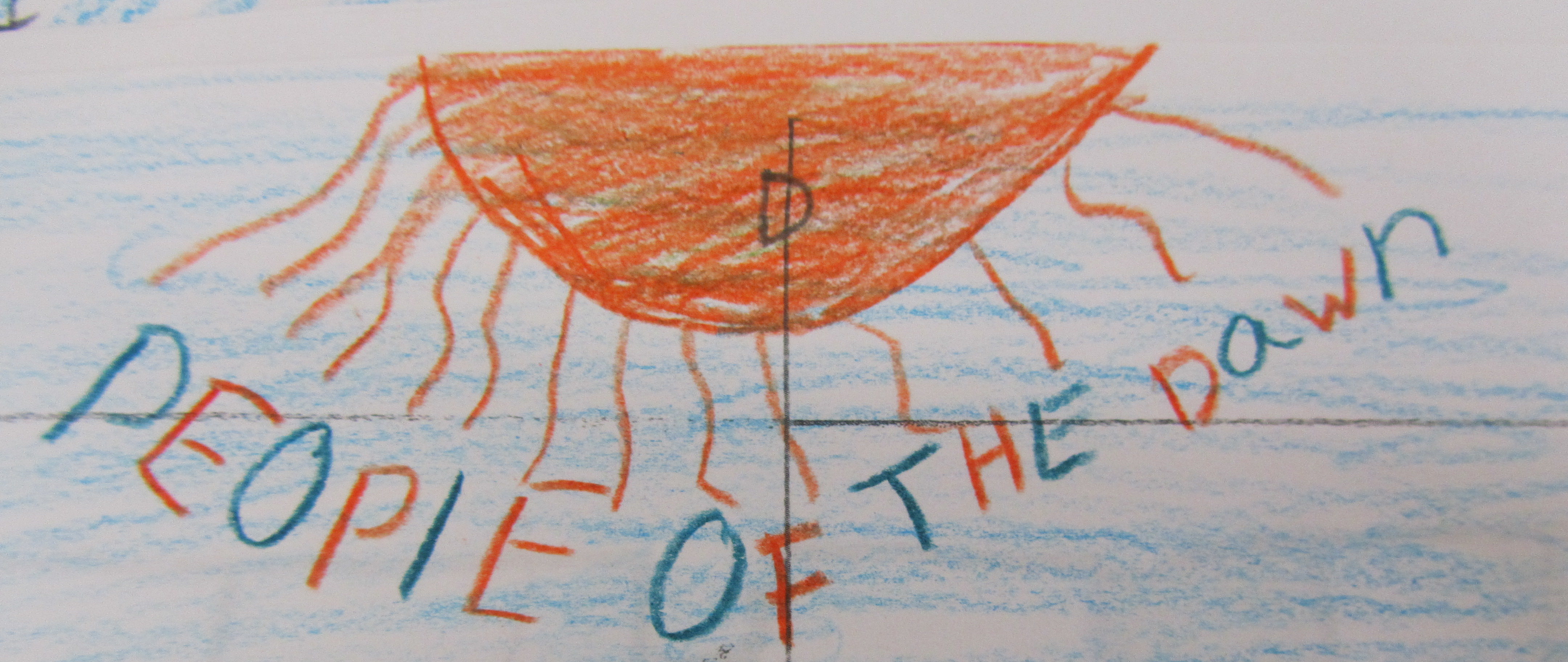
- Discuss with students where the sun rises (east) and sets (west). Together, note that the Atlantic Ocean (at the top of the page) is east. Have students mark “East” on the edge of the paper and draw in a rising sun. Label the sun area with Wôbanakiak (or Abenaki) which means “People of the dawn”. Label the Connecticut River with “Kwanitekw” and it’s translation “long river.”
-
-
- Choose some other place names for students to write onto the maps. Have students illustrate each place name. Use the grids to help them put place names in the correct locations.
- Concluding Discussion
-
What are marks some of the boundaries of the Abenaki homeland? Waterways. Why might that be?